

Peru Earthquake: Magnitude 6.7 Quake Shakes Southern Andes, No Major Damage Reported
Peru Earthquake: Magnitude 6.7 Quake Shakes Southern Andes, No Major Damage Reported
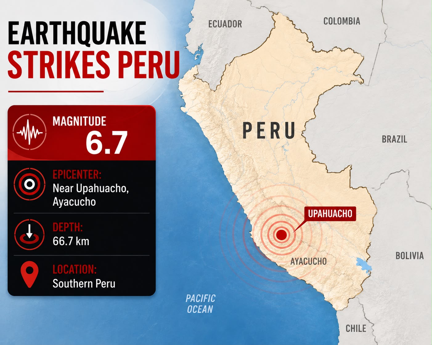
Peru Earthquake Latest News: A strong earthquake struck southern Peru on Thursday, August 20, 2026, with the U.S. Geological Survey (USGS) reporting a magnitude of 6.7. The earthquake was centred near Upahuacho in the Ayacucho region and was felt across parts of southern Peru.
Initial reports indicated that there were no immediate reports of major casualties or widespread damage. Authorities continued assessing infrastructure and monitoring the region for possible aftershocks.
Peru Earthquake: Key Details
- Date: August 20, 2026
- Country: Peru
- Region: Southern Peru / Ayacucho
- Magnitude: 6.7, according to USGS
- Epicentre: Near Upahuacho, Ayacucho
- Depth: Approximately 66 km
- Areas reporting shaking: Ayacucho, Ica, Arequipa and surrounding areas
- Tsunami threat: No tsunami threat reported
- Immediate damage: No major widespread damage reported in initial assessments
Strong Earthquake Hits Southern Peru
The earthquake struck during the afternoon local time and produced noticeable shaking in several areas. The epicentre was located in the mountainous Ayacucho region, an area with a long history of seismic activity.
The earthquake's depth was approximately 66 kilometres, according to the USGS. The depth and location of an earthquake can influence how strongly shaking is experienced at the surface and how widely the tremors are felt.
Local authorities and emergency agencies began monitoring the situation following the earthquake, particularly for possible structural damage, landslides and aftershocks.
Why Is Peru Prone to Earthquakes?
Peru is one of the world's most seismically active countries because it lies along the Pacific Ring of Fire.
The country's seismic activity is largely driven by the movement of the Nazca Plate beneath the South American Plate. This process, called subduction, generates enormous geological pressure beneath the Earth's surface.
When accumulated stress is released, seismic energy travels through the Earth's crust in the form of waves, causing an earthquake.
This tectonic setting makes earthquakes a regular occurrence in Peru, although their magnitude and impact can vary considerably.
No Tsunami Threat Reported
Despite the strength of the earthquake, authorities reported no tsunami threat associated with the event.
Tsunamis can occur when a sufficiently strong undersea earthquake causes significant displacement of the ocean floor. In this case, the earthquake's location and characteristics did not result in a tsunami threat for Peru's Pacific coastline.
Authorities Monitor Aftershock Risk
Aftershocks are common following significant earthquakes. They can occur in the hours and days following the main tremor and may sometimes be strong enough to cause additional damage, particularly to buildings that have already been weakened.
Residents in affected areas have been advised to remain alert, stay away from damaged structures and follow instructions issued by local emergency authorities.
Earthquake Safety: What Should You Do?
During an earthquake, experts recommend the Drop, Cover and Hold On approach.
Drop: Get down to prevent being knocked over.
Cover: Protect your head and neck and, if possible, take shelter beneath a sturdy table or desk.
Hold On: Remain in position until the shaking stops.
People should avoid using elevators during an earthquake and should stay away from windows, glass and unstable structures.
After the shaking stops, people should check for injuries, move away from damaged buildings and follow official emergency instructions.
Peru's Long History of Major Earthquakes
Peru has experienced several major earthquakes because of its location along the active Pacific tectonic boundary.
One of the country's most devastating recent earthquakes occurred in August 2007, when a powerful earthquake struck the Ica region, killing hundreds of people and causing extensive damage.
The country's seismic history demonstrates the importance of earthquake-resistant construction, emergency preparedness and rapid response systems.
What Happens Next?
Authorities are expected to continue monitoring southern Peru for aftershocks and assessing infrastructure in affected areas.
Particular attention is likely to be given to:
- Roads and bridges
- Residential buildings
- Schools and hospitals
- Electricity and telecommunications infrastructure
- Water supply systems
- Mountain roads and slopes
- Areas vulnerable to landslides
While the initial assessment is reassuring, damage assessments can take time, particularly in remote mountainous areas.
Magnitude Reports May Change
Earthquake measurements can differ between seismic monitoring agencies, particularly immediately after a major event. Preliminary magnitude and location estimates may be revised as additional seismic data becomes available.
For international reporting, the USGS magnitude of 6.7 is used in this report, while readers should be aware that Peruvian authorities may provide different estimates.
Conclusion
The August 20, 2026 Peru earthquake was a significant seismic event that shook the country's southern Andes and was felt across several regions.
The USGS recorded the earthquake at magnitude 6.7, with the epicentre near Upahuacho in Ayacucho and a depth of approximately 66 kilometres. Initial reports indicated no major widespread damage or casualties, while authorities continued their assessment.
The earthquake once again highlights Peru's exposure to seismic hazards due to its position along the Pacific Ring of Fire. Continued monitoring, earthquake-resistant infrastructure and public preparedness remain essential for reducing the impact of future earthquakes.
Disclaimer: Earthquake magnitude, epicentre, depth, damage and casualty figures can be revised as seismic agencies and local authorities receive additional information.
What's Hot
-

Asian Games 2026: India Wins Double Kabaddi Gold, Medal Tally Reaches 28
-

Trump Moves to Cancel Nearly Dollar 1 Billion in Congress-Approved Funding
-

PM Modi Calls Bhajan Clubbing “Spectacular”: What It Is All About
-

Tata Aeris Launch 2026: New Compact Sedan to Replace Tigor, Price, Features, Engine, CNG and EV Details
-

India’s Semiconductor Push: Whole-of-Industry Approach to Boost Electronics Manufacturing
-

National Film Awards 2026 Winners: Yami Gautam, Kartik Aaryan, Mammootty, Pushpa 2
-

PM Kisan 24th Installment Date 2026: When Will ?2,000 Be Credited?
-

Xi Jinping's US Visit: What It Means for the World Economy
-

ndia is rapidly expanding renewable energy, but transmission bottlenecks and limited storage are causing clean electricity to be curtailed. Here's what it means.
-

SEO Title: Mahindra Thar OG Launched at INR 10.32 Lakh: Price, Features & Specs